
NOAA plans to test Saildrones for Arctic Ocean mapping
The U.S. hopes to get a clearer picture of its Arctic waters using unmanned marine vehicles and sonar imaging systems.
January 22, 2019
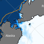
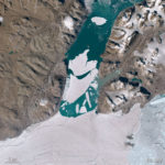
The Arctic Ocean is expected to see a rise in traffic as ice melts and seas warm. Yet according to some estimates, only 4.7 percent of the region is charted to modern standards. Others put that figure even lower, at less than 2 percent.
Access to content from the Arctic Knowledge Archives is available to Passport holders only.
Arctic Today is a non-profit organization, supported by donations from readers like you. While we strongly believe in giving free access to current news for all readers, we reserve content older than one year for our supporters. All individual contributions of at least $20/month or $150/year will receive a Passport to the Arctic Knowledge Archives. Help us drive the leading non-profit editorial team dedicated to delivering context, information and analysis about events in the Arctic.
Already have a Passport? Sign in
choose your level of support and unlock your Arctic Passport.
- Monthly
- Annually
- Groups & Institutions
Individual Annual
$150.00
Year
Individual Monthly
$20.00
Month
Individual Monthly
$20.00
Month
Individual Yearly
$150.00
0